Innovative Technologies in Sand Dune Dynamics: Predicting Landscape Evolution
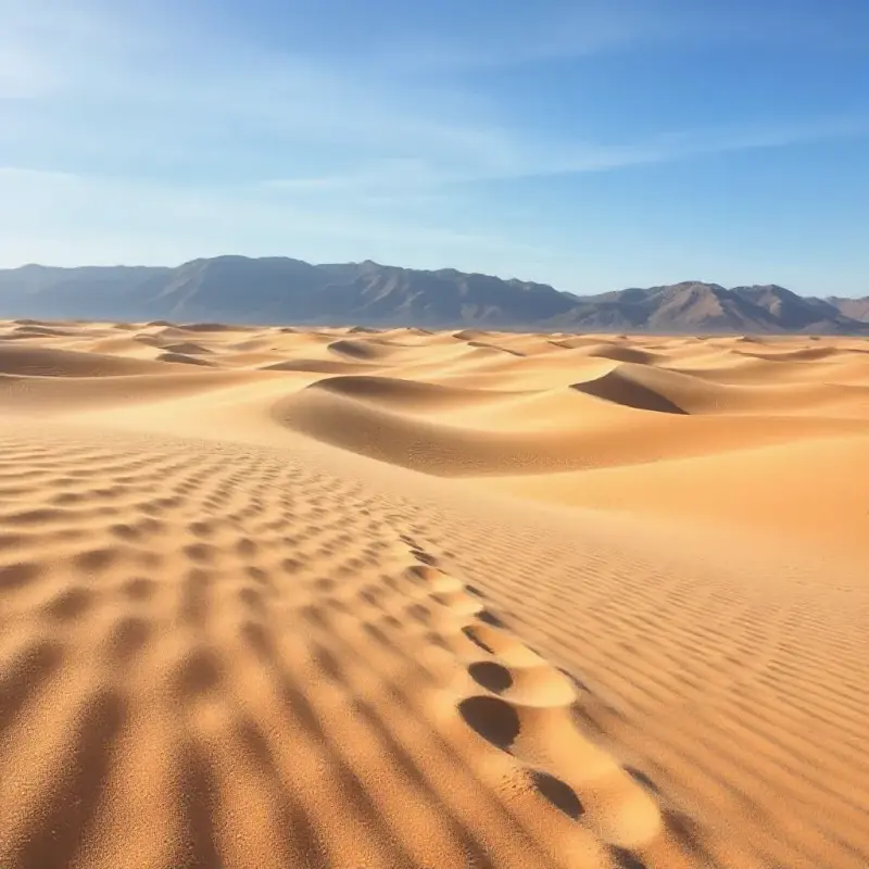
Sand dunes are captivating natural features that have intrigued geologists, environmentalists, and ecologists for centuries. These shifting landforms, shaped by the wind's force and the passage of time, are constantly evolving, creating dynamic and ever-changing landscapes. Understanding how sand dunes move and transform is not only essential for advancing scientific knowledge but also plays a crucial role in practical applications like land management, urban planning, and environmental conservation.
In recent years, technological advancements have significantly improved the methods used to study and predict the movement of sand dunes. From satellite imagery and remote sensing to artificial intelligence (AI) and machine learning, modern tools are providing new insights into the behavior of these landscapes, allowing for more precise forecasts and better management strategies.
This article will explore the role of these innovative technologies in studying sand dune dynamics and how they help predict changes in the landscape, offering a glimpse into the future of geomorphological research and its applications.
The Importance of Studying Sand Dune Movement
Sand dunes play a crucial role in shaping desert ecosystems. These ever-shifting formations are responsible for altering local climate conditions, impacting vegetation, wildlife, and even human settlements. The study of their movement is essential for understanding how sand dunes influence the environment and human activities, as well as for mitigating potential risks posed by their encroachment on infrastructure.
The movement of sand dunes can lead to the destruction of crops, damage to buildings, and even disrupt transportation systems. On the other hand, these landscapes also offer opportunities for innovation in fields like renewable energy, agriculture, and tourism. Therefore, understanding sand dune dynamics is vital for both protecting vulnerable areas and harnessing the potential benefits these landscapes offer.
Traditional Methods of Studying Sand Dunes
Historically, the study of sand dunes was carried out through field-based methods such as direct observation and manual measurements. Researchers would track the movement of sand particles and assess the physical properties of the dunes, often using basic tools like rulers, compasses, and tape measures. While these methods provided valuable information, they were limited in scope and accuracy, especially when it came to tracking dune movement across large areas or over extended periods of time.
In addition to field measurements, scientists also relied on basic computational models to simulate dune movement. These models used simplified equations to predict the flow of sand and how dunes would evolve. However, they often lacked the precision required to account for the complex interactions between wind, vegetation, and other environmental factors.
As technology advanced, new methods emerged to overcome these limitations, allowing for more comprehensive and detailed analyses of sand dune dynamics.
The Role of Technology in Studying Sand Dunes
In recent years, new technological tools have transformed the way scientists study sand dunes. The combination of remote sensing, geospatial analysis, and artificial intelligence has provided a powerful toolkit for monitoring and predicting the movement of these landscapes. These technologies enable researchers to collect vast amounts of data over large areas, providing a more complete picture of dune behavior and making it possible to make more accurate predictions.
Remote Sensing Technologies
Remote sensing, which involves the use of satellites and other airborne platforms to collect data from a distance, has become one of the most important tools in the study of sand dunes. Satellite imagery allows scientists to monitor dune movement over large geographical areas and extended time periods, something that would be difficult or impossible with traditional field-based methods.
High-resolution images captured by satellites, such as those from Landsat and MODIS (Moderate Resolution Imaging Spectroradiometer), offer detailed insights into the shifting patterns of sand dunes. These images can be analyzed to track changes in dune formation, size, and location over time. This long-term monitoring allows researchers to detect trends in dune movement and identify areas at risk of sand encroachment.
Artificial Intelligence and Machine Learning
One of the most exciting developments in the study of sand dunes is the integration of artificial intelligence (AI) and machine learning. These technologies allow researchers to analyze large datasets and identify complex patterns that would be difficult to detect with traditional methods.
Machine learning algorithms can be trained to recognize specific features in remote sensing images, such as the shape and size of dunes, and track how they change over time. This enables more accurate predictions of future dune movements. AI models can also help identify the factors that influence dune dynamics, such as wind speed, vegetation cover, and the topography of the land.
By applying AI and machine learning to sand dune studies, researchers can create predictive models that offer a deeper understanding of how dunes move and evolve under different environmental conditions. These models can be used to forecast future changes in the landscape, which is invaluable for planning purposes in areas affected by desertification or sand encroachment.
Geospatial Analysis and Predictive Modeling
Geospatial analysis tools, such as Geographic Information Systems (GIS), have further enhanced our ability to study sand dunes. GIS allows researchers to overlay different types of data, such as satellite imagery, wind patterns, and vegetation cover, to create detailed models of dune landscapes.
These models can be used to predict how dunes will behave in the future under various scenarios. For example, researchers can simulate how a dune will move in response to changes in wind direction or how the installation of windbreaks might affect dune migration. This ability to predict the future behavior of sand dunes is crucial for urban planning, land conservation, and disaster prevention.
Case Studies and Applications of Technology in Sand Dune Research
The application of these technologies has already yielded valuable insights into the dynamics of sand dunes. In areas such as the Middle East, where rapid urbanization has led to the encroachment of dunes on cities, predictive models have been used to design resilient urban infrastructure that can withstand the forces of nature. By anticipating how sand dunes will move, cities can be planned in ways that minimize the risk of sand infiltration and damage.
In environmental conservation efforts, technologies like remote sensing and GIS are helping scientists monitor dune ecosystems. These technologies allow for the tracking of vegetation growth, animal habitats, and other ecological factors that are influenced by dune movement. By understanding how dunes affect the surrounding environment, conservationists can develop strategies to protect vulnerable species and ecosystems.
Challenges and Future Directions
While technological advancements have significantly improved the study of sand dunes, there are still challenges to overcome. Predicting dune movement with complete accuracy remains difficult due to the complex interactions between natural forces, such as wind, water, and vegetation. Additionally, the effects of climate change on sand dune dynamics are not yet fully understood, making it challenging to predict how dunes will behave in the future.
Despite these challenges, the future of sand dune research looks promising. As technology continues to evolve, researchers will be able to gather even more precise data, allowing for better predictions and more effective management of these landscapes.
Conclusion
Innovative technologies, such as remote sensing, artificial intelligence, and geospatial analysis, have revolutionized the way we study sand dunes and predict their movement. These tools have provided valuable insights into the dynamics of dune landscapes and are helping to inform decisions related to urban planning, environmental conservation, and risk management. As research continues and technology advances, our understanding of sand dunes will only become more refined, offering new opportunities for managing and harnessing the power of these fascinating natural formations.
Artikel
Registrieren Sie sich für unsere Benachrichtigungen, um die neuesten und spannendsten Artikel direkt in Ihrem Posteingang zu erhalten!